

by Indeewari Chandrasekara
What is GPS + IoT for Vehicle Tracking?
The Global Positioning System (GPS) is a network of satellites and receiving devices used to determine the location of something on Earth. It can pinpoint a three-dimensional position to meter-level accuracy and time to the 10-nanosecond level, worldwide and 24/7. Owned by the US Government and operated by the United States Air Force (USAF), the GPS receivers are programmed to receive information about where each satellite is at any given moment. A GPS receiver determines its own location by measuring the time it takes for a signal to arrive at its location from at least four satellites. Some GPS receivers are so accurate they can establish their location within 1 centimeter. GPS systems are extremely versatile and can be found in almost any industry sector.
Three main industrial uses of GPS include precision agriculture, automotive and defense. GPS is invaluable to an IoT system since it quantifies and records location, speed, time, and direction and hence GPS along with IoT technology can be used to track vehicles to obtain meaningful information for operational decision making.
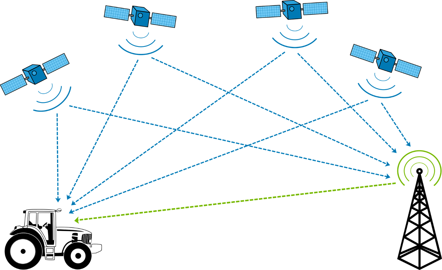
GPS Satellite Navigator Scheme
A vehicle tracking system is a system that uses GPS satellites to allow tracking and management of vehicles via an online computer, smartphone, or tablet. While GPS data transmitted to a host over a mobile data connection is enough to track the moment of a vehicle in real time, IoT essentially makes vehicle tracking solutions a lot more efficient, economical, automated, and reliable. IoT technology is how physical objects are connected and linked through sensors, communicating with each other and controlled via the internet and monitored using platforms such as the ANANKE IoT Platform.
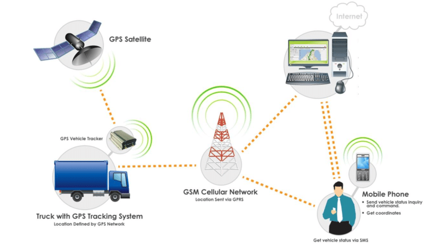
Communication within a GPS based Vehicle Tracking System
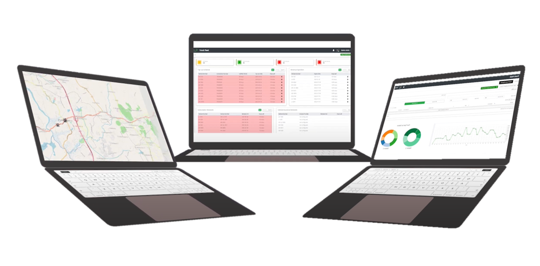
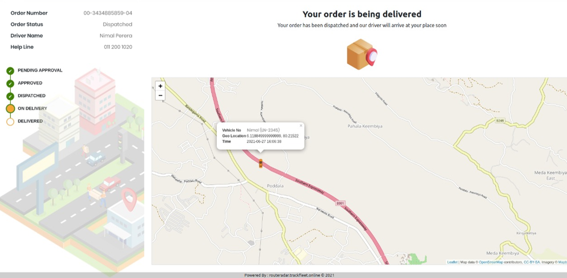
Route Radar Tracking Application
Route Radar Tracking Application is a GPS based application developed in 2013 by a team of Electronic and Telecommunication Engineers at Effective Solutions and Transport domain industry consultants. Route Radar was developed to track and monitor multiple fleet and sales teams on field as it can calculate and provide mileage and fuel consumption reports along with add-on sensor metrics. ANANKE IoT platform handles all the communications with the devices and the platform is flexible to host on client servers or the cloud.
The main objective of Route Radar tracking platform is to allow businesses to closely monitor their fleet and keep records of where journeys, distribution and deliveries are occurring in order to keep track of all fleet related costs logged at one place approachable for relevant people in the hierarchy.
Route Radar Tracking Application
Apart from GPS tracking Route Radar also supports advanced fuel card integration, fuel sensor installation, OBD Port tapping, other sensor installations for compartment’s temperature/ humidity/ vibration and door sensors etc. The platform is flexible to use for any standard GPS device available in the market and the default GPS device which Route Radar recommends, includes a memory backup and has a 3 hour built-in battery life even after disconnection from the vehicle battery in any given moment.
Route Radar, More Than an Application
When it comes to customer convenience, it is being implemented in a way that from device installations to on-site and off-site testing to organization hierarchy mapping, the services are carried out by experienced technicians and business analysts at Route Radar. On-site, a series of testing is being carried out to ensure the device/s is precisely fixed and data is being fed to the platform with no room for error. Other integrated scenarios such as ignition (for parking and idling), over speeding, authorized driving and immobilizer are also being checked.
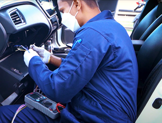
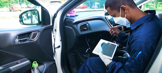
On-site Device Installations and Testing
Use of Route Radar
Whether Route Radar is used as a personal application for individual use or for enterprise multidimensional requirements, Route Radar can be deployed as a ready-to-use platform or as a highly customizable or API integrated service. There are several key benefits to the user from Route Radar;
- Remotely monitor the fleet with less time
- Monitor driver behaviour and get performance records
- Reduce time and effort making running charts and mileage reports
- Track the fuel consumption and control fuel expenses of the fleet
- Analyse and report fleet performance to business stakeholders at any time
- Track and share deliveries with internal and external parties journey wise
- Optimize the vehicle operational and maintenance cost
- Flag waste in the operation (e.g. Idle time, Overspeed fuel burnt)
- Safeguard the field workforce (e.g. Establish speed limits alerts)
Track Your Deliveries with Route Radar API
Route Radar also keeps all fleet related administrative data safely within the platform along with top management presentable dashboards and analytics. Authorized organizational users can maintain the detailed logs of vehicle maintenance and can configure the entire organization hierarchy for fleet monitoring and management within the platform. This allows several user level access and automates the emailing of reports through the platform.
On the other hand, by integrating the company fuel card system to Route Radar, whenever the fuel tank gets refilled, the platform will record it real-time and generate a fuel report with the platform saved data. This lets the users track fuel pumped and compare with fuel consumption to flag any misuse. Apart from that the geo-fence feature allows users to protect vehicles from theft or misuse by establishing safe zones or geo-fences as the platform instantly generates an alert when the tracker signal enters or leaves an assigned virtual border. This feature can also be used to monitor whether vehicles enter and exit designated locations and routes in the operation.
Future of GPS + IoT Tracking
The future of GPS and IoT based tracking seems to be very bright as concepts like remotely monitoring, operational efficiency and resource optimization have received special attention during the recent years. These platforms will be continuously enhanced for loading speed, minimum latency and higher accuracy and capacity. Flexibility for customization will also be an integral head turner in this market as with business processes becoming complex day by day, demand for tailor made solutions to cater the unique requirements become necessary.